A hiking app can help you find a quiet local trail, plan a multi-day backpacking route, check elevation gain, and navigate when cell service disappears. The tricky part is that no single app does every one of those jobs equally well.
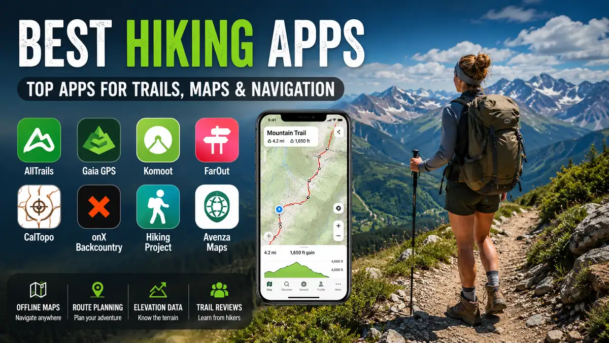
The best hiking apps combine useful trail information with dependable mapping and GPS tools. AllTrails is particularly strong for discovering established hikes and reading community reports, Gaia GPS and CalTopo offer deeper backcountry mapping, Komoot excels at route planning, FarOut specializes in long-distance trails, and onX Backcountry adds detailed terrain and land-access information.
The right choice depends less on which app has the longest feature list and more on where—and how—you hike.
best hiking apps at a Glance
Here is a practical comparison before we look at each option in detail.
| Hiking App | Best For | Offline Maps | Route Planning | Standout Feature |
|---|---|---|---|---|
| AllTrails | Trail discovery | Yes, eligible plans | Yes | Huge community trail database |
| Gaia GPS | Backcountry navigation | Yes | Advanced | Detailed topo and map layers |
| Komoot | Route planning | Yes | Excellent | Turn-by-turn route guidance |
| FarOut | Thru-hiking | Yes | Trail-focused | Water, campsites and trail waypoints |
| CalTopo | Advanced navigation | Yes, depending on plan | Excellent | Professional-grade mapping tools |
| onX Backcountry | Remote terrain and access | Yes | Advanced | Land boundaries and terrain layers |
| Hiking Project | Finding established trails | Limited compared with dedicated offline tools | Basic | Community trail information |
| Avenza Maps | Official and specialty maps | Yes | Map-focused | Georeferenced PDF maps |
There is an important distinction here: trail discovery and wilderness navigation are not the same thing.
An app can be excellent at showing popular trails, photos, reviews, and difficulty ratings while offering fewer tools for reading complex terrain. Likewise, a sophisticated topographic mapping app can be excellent in the backcountry but feel unnecessarily complicated when you simply want a three-mile hike near home.
1. AllTrails — Best for Finding Hiking Trails
AllTrails is usually the easiest starting point for hikers who want to answer a simple question: Where should I hike?
Its strength is discovery. You can search established routes, inspect distance and elevation information, browse photos, and read reports from people who have recently visited the trail.
That community layer is valuable because a line on a map cannot tell you everything about current conditions.
Recent hikers may mention mud, snow, washed-out sections, difficult creek crossings, parking problems, closures, or confusing junctions. Those reports can provide useful context before leaving home.
What AllTrails does well
AllTrails is particularly useful for:
- Finding hikes near a destination
- Filtering routes by difficulty and length
- Checking elevation gain
- Viewing trail photos
- Reading community reviews
- Recording completed activities
- Saving routes
- Navigating established trails
- Downloading eligible maps for offline use
AllTrails currently allows Plus and Peak members to download maps to a phone. Once downloaded, the maps can be viewed while the phone uses its built-in GPS even without a mobile-data signal.
Where AllTrails is weaker
Crowdsourced information needs judgment.
A trail being labeled “moderate” does not guarantee that every hiker will consider it moderate. Fitness, altitude, weather, snow, exposure, trail maintenance, and pack weight can completely change the experience.
Reviews can also become outdated.
For popular day hikes, AllTrails is one of the most convenient choices available. For complicated off-trail travel or detailed terrain analysis, a map-first tool such as Gaia GPS or CalTopo may be more appropriate.
Quick takeaway: Choose AllTrails when discovering established hikes and checking recent community information are your priorities.
2. Gaia GPS — Best for Backcountry Hiking
Gaia GPS approaches hiking from the opposite direction.
Instead of making trail reviews the center of the experience, it puts maps and navigation first. That makes it particularly useful for backpackers, experienced hikers, and people traveling through remote terrain.
Topographic information becomes much more important once a route moves beyond a straightforward, heavily marked path.
Contour lines can help you identify ridges, valleys, saddles, drainages, steep slopes, and alternative routes. Satellite imagery provides another perspective on the landscape.
Gaia GPS is designed around this deeper mapping workflow.
Why experienced hikers use Gaia GPS
Its strengths include:
- Topographic mapping
- Multiple map layers
- Satellite imagery
- Offline maps
- GPS track recording
- Waypoints
- Elevation profiles
- Custom route planning
- GPX data
- Backcountry-oriented navigation
The difference becomes obvious when planning a trip rather than simply searching for one.
Suppose your route crosses a pass, follows an indistinct trail, and then descends into a drainage. A simple trail line tells you where the intended route goes. A detailed topo map helps you understand why it goes there and what the surrounding landscape looks like.
That extra context matters when conditions force a decision.
Gaia GPS vs AllTrails
For many hikers, this is the most useful comparison.
Choose AllTrails primarily for discovering established trails, reviews, photos, and community information.
Choose Gaia GPS when topographic detail, custom planning, offline navigation, and understanding surrounding terrain matter more.
Some hikers use both: AllTrails during the research stage and Gaia GPS for navigation.
Quick takeaway: Gaia GPS is better suited to hikers who want the smartphone equivalent of a serious backcountry mapping toolkit rather than primarily a trail directory.
3. Komoot — Best for Planning Custom Hiking Routes
Komoot sits between trail discovery and technical mapping.
Its strongest feature is route planning.
Rather than limiting you to a catalog of predefined hikes, Komoot can help construct a route around where you actually want to travel. That makes it useful for hiking, walking, cycling, bikepacking, and other route-based outdoor activities.
What makes Komoot different?
Komoot emphasizes the journey between points.
Its route-planning tools can help hikers examine:
- Distance
- Elevation
- Trail and path choices
- Route surfaces
- Highlights
- Points of interest
- Planned tours
- Turn-by-turn navigation
This can be especially helpful when connecting several paths into one custom loop or planning a longer point-to-point journey.
Komoot also supports downloaded routes for offline navigation. Regional maps can be downloaded where the user’s access and regional availability allow it.
That matters because a planned route should not suddenly become inaccessible when mobile coverage disappears.
Who should use Komoot?
Komoot makes sense for hikers who enjoy planning their own adventures rather than simply selecting a predefined trail.
It is also particularly useful when one app needs to handle multiple outdoor activities.
For detailed wilderness terrain analysis, Gaia GPS or CalTopo may provide a more technical mapping environment. For pure trail discovery, AllTrails may feel faster.
For building a route and then following it, Komoot is one of the strongest options.
4. FarOut — Best for Thru-Hikers and Long-Distance Trails
A weekend day hike and a five-month thru-hike have very different information requirements.
FarOut is built around the latter.
The app specializes in long-distance hiking, biking, and paddling routes and currently offers more than 250 trail guides. Its major hiking coverage includes routes such as the Appalachian Trail, Pacific Crest Trail, and Continental Divide Trail.
Instead of focusing only on where the trail goes, FarOut organizes the practical information that long-distance hikers repeatedly need.
That includes:
- Water sources
- Campsites
- Trail junctions
- Elevation profiles
- Resupply-related information
- Important waypoints
- Offline GPS maps
- Community trail updates
Why waypoint information matters
On a normal day hike, knowing the next reliable water source may be irrelevant.
On a long-distance backpacking route, it can determine how much water you need to carry for the next several hours.
The same applies to campsites, road crossings, trail towns, and other logistical points.
FarOut’s trail guides are created with long-distance travelers in mind, which is why its usefulness becomes greater as the trip becomes longer and more logistically complicated.
Is FarOut useful for ordinary day hiking?
It can be, but that is not its primary advantage.
Someone searching for hundreds of nearby weekend hikes will probably find AllTrails more convenient. Someone following a major long-distance trail may find FarOut considerably more relevant.
Quick takeaway: FarOut is a specialized tool. That specialization is exactly what makes it so useful for thru-hikers.
5. CalTopo — Best for Advanced Route Planning
CalTopo is for hikers who want to understand the map rather than simply follow a highlighted line.
It has long been associated with detailed backcountry planning and is particularly attractive to advanced hikers, mountaineers, backcountry skiers, trip leaders, and people who regularly work with topographic information.
The interface can require more learning than mainstream hiking apps, but that complexity provides considerably more control.
What can advanced mapping tell you?
Detailed terrain tools can help you analyze:
- Contour patterns
- Slope steepness
- Elevation
- Ridges and drainages
- Satellite imagery
- Routes and tracks
- Waypoints
- Large-scale trip plans
Slope-angle information can be particularly useful when evaluating steep terrain, although an app alone cannot determine whether terrain is safe.
This distinction matters.
Navigation software provides information. It does not replace the skills required to interpret that information.
CalTopo vs Gaia GPS
Both appeal to serious backcountry users.
Gaia GPS generally provides a more approachable mobile experience for many recreational hikers. CalTopo is compelling when detailed planning and technical map analysis are the priorities.
People who enjoy creating precise routes on a larger screen before transferring them to a phone or GPS device may particularly appreciate CalTopo’s planning-oriented workflow.
For a simple afternoon walk, it can be more mapping power than necessary.
For a complicated wilderness route, that extra capability can become the reason to use it.
6. onX Backcountry — Best for Land Access and Remote Terrain
Not every navigation problem is about finding the trail.
Sometimes the real question is: Am I allowed to be here?
That is where onX Backcountry becomes interesting.
The app combines outdoor navigation with detailed public and private land information, making it especially useful in places where trail access and land ownership can become complicated.
It also includes terrain-oriented tools such as topographic mapping, satellite views, 3D terrain, slope-angle information, waypoints, route building, and offline navigation.
Offline hiking with onX
You can save an area before leaving service and then use your phone’s internal GPS to display your position on the downloaded map. Saved trails, topo information, waypoints, lines, and other content can remain available within downloaded areas.
This makes onX useful for:
- Backpacking
- Remote hiking
- Public-land exploration
- Route planning
- Checking land boundaries
- Marking campsites and water sources
- Tracking a route
- Studying terrain before departure
Why land boundaries matter
A trail can cross a complicated patchwork of federal, state, local, and private property.
Knowing those boundaries helps hikers avoid accidental trespassing and identify legitimate access routes.
This is less important on a clearly marked national-park trail, but potentially much more important when exploring remote public lands.
Quick takeaway: onX Backcountry is particularly valuable when terrain navigation and understanding public/private land access are both part of the trip.
7. Hiking Project — Best for Straightforward Trail Information
Not everyone needs dozens of map layers.
Hiking Project is useful for people who want straightforward information about established hiking trails without turning route planning into a technical exercise.
Its community-oriented trail information can help users understand routes, descriptions, distances, and what to expect.
The appeal is simplicity.
If your typical trip involves selecting a known trail, checking the route, and heading out for a few hours, a lighter trail-focused app may provide everything you actually need.
Who is Hiking Project best for?
Consider it if you:
- Mostly hike established trails
- Prefer straightforward trail descriptions
- Want to browse hiking routes
- Do not need sophisticated land-ownership layers
- Rarely travel off trail
- Find advanced mapping apps overwhelming
For remote navigation, however, dedicated tools with robust offline maps and advanced topo capabilities provide more flexibility.
8. Avenza Maps — Best for Official and Specialty Maps
Avenza Maps solves a different problem from most hiking apps.
Instead of primarily providing one universal outdoor basemap, it allows users to work with georeferenced maps, including specialized maps from different publishers and organizations.
That can be extremely useful when a land manager, park, government agency, or professional mapmaker provides a map specifically designed for the area you are visiting.
Why use a georeferenced map?
A traditional PDF trail map is just an image.
A georeferenced map contains geographic information that lets compatible software understand where features on that map exist in the real world.
With GPS positioning, this can allow you to see your approximate location directly on the map.
That combination can be useful for:
- Parks
- Wilderness areas
- Public lands
- Specialized recreation maps
- Regional trail systems
- Government-produced maps
Avenza is therefore less about discovering the most popular hike nearby and more about carrying the right map for a particular place.
Which Hiking App Has the Best Offline Maps?
For serious offline navigation, Gaia GPS, CalTopo, and onX Backcountry are among the strongest options, while Komoot provides useful offline support for planned routes and regions. AllTrails also supports downloaded maps through eligible memberships. FarOut’s offline maps are particularly well suited to supported long-distance trails.
But there is a common misunderstanding about offline hiking apps.
GPS and mobile data are different things
Your smartphone’s satellite positioning can work without an active cellular connection.
The problem is the map data.
If an app normally downloads its map from the internet as you move, losing connectivity can leave you with a GPS position but no useful map underneath it.
That is why downloading the map before leaving home matters.
How to prepare an offline hiking app correctly
Before a hike:
- Download the entire route area.
- Include extra terrain around your intended path.
- Wait until the download is completely finished.
- Switch the phone to airplane mode.
- Open the app.
- Confirm that the map still displays.
- Zoom through the route at several levels.
- Check that your planned route and important waypoints appear.
- Make sure your phone is adequately charged.
Do not download only a narrow strip directly around the trail.
Weather, closures, navigation mistakes, injuries, or changing conditions may force you away from the original route. Having surrounding terrain available gives you far more context.
How to Choose the Best Hiking App for Your Needs
Ignore the temptation to choose based on the number of features.
Start with the type of hiking you actually do.
For casual day hikes
Prioritize:
- Easy trail search
- Difficulty filters
- Photos
- Reviews
- Elevation gain
- Straightforward navigation
Best fit: AllTrails or Hiking Project.
For backcountry hiking
Prioritize:
- Topographic maps
- Offline map downloads
- Waypoints
- Custom routes
- GPX support
- Satellite imagery
- Detailed elevation information
Best fit: Gaia GPS, CalTopo, or onX Backcountry.
For custom route planning
Prioritize:
- Route creation
- Elevation profiles
- Trail surfaces
- Turn-by-turn directions
- Offline routes
Best fit: Komoot.
For thru-hiking
Prioritize:
- Water-source information
- Campsites
- Resupply context
- Community updates
- Trail-specific waypoints
- Reliable offline operation
Best fit: FarOut.
For complicated land access
Prioritize:
- Public-land boundaries
- Private-property information
- Access points
- Topographic context
- Offline maps
Best fit: onX Backcountry.
Free vs Paid Hiking Apps: What Actually Matters?
Many hiking apps can be downloaded for free, but the download price tells you very little about their useful offline functionality.
The key question is:
Which features work without paying?
Check specifically whether the free version includes:
- Offline maps
- Custom route creation
- Multiple map layers
- Turn-by-turn navigation
- GPX import/export
- 3D terrain
- Satellite imagery
- Advanced trail filters
- Emergency or location-sharing features
Offline maps are especially important.
An app may be excellent while connected to the internet but lose much of its usefulness once you move outside coverage.
Before paying for any subscription, think about your hiking frequency.
A casual walker who completes well-marked local trails may need little more than a basic free trail app. A backpacker spending several days outside cell coverage may get considerably more value from advanced offline maps and topo layers.
Can You Use Google Maps for Hiking?
Google Maps can help with driving to a trailhead and understanding the broader area, but it should not automatically be treated as a dedicated backcountry navigation tool.
Purpose-built hiking apps provide features that matter specifically outdoors, such as:
- Hiking trail databases
- Topographic information
- Elevation profiles
- Trail-specific waypoints
- GPX routes
- Backcountry map layers
- Detailed offline trail maps
The more remote or complicated the hike becomes, the more valuable those specialized tools become.
How Accurate Are Hiking Apps?
A hiking app’s blue location dot comes from the positioning capabilities of your phone, but several factors can affect what you see.
Dense tree cover, cliffs, deep valleys, device hardware, satellite visibility, and map-data quality can all influence the apparent position.
More importantly, a precise GPS position does not guarantee that the underlying trail information is correct.
Trails can be:
- Rerouted
- Closed
- Washed out
- Covered by snow
- Poorly maintained
- Incorrectly mapped
- Blocked by fire or storm damage
Treat community reports as useful observations rather than permanent facts, and check official land-management information when closures, permits, wildfire restrictions, or access rules matter.
Battery Life Is Part of Navigation
A perfect offline map is useless if the phone holding it is dead.
Continuous GPS recording, a bright screen, cold weather, background apps, and frequent map checking can consume significant battery power.
For longer hikes:
- Start with a full charge.
- Use airplane mode when appropriate.
- Reduce screen brightness.
- Keep the phone warm in cold conditions.
- Avoid unnecessary background activity.
- Carry a suitable power bank on longer trips.
- Record continuously only when you actually need a track.
Do not assume a phone that lasts all day at home will behave the same way during an eight-hour GPS-heavy hike.
A Hiking App Should Not Be Your Only Navigation Plan
Smartphones have made outdoor navigation dramatically more convenient, but electronics can still fail.
A phone can be dropped, soaked, frozen, damaged, or simply run out of power.
For remote trips, consider carrying an appropriate backup such as a paper topographic map and compass—and know how to use them. For higher-risk or truly remote travel, a satellite communicator or personal locator device may provide another layer of emergency preparedness.
A downloaded map also does not make an unsafe route safe.
Weather forecasts, wildfire information, avalanche conditions, permits, official closures, water availability, daylight, and personal ability all need separate consideration.
What Actually Works Before a Hike
A good navigation routine is surprisingly simple.
First, research the route and recent conditions. Then inspect the terrain rather than looking only at mileage.
Download the map while you still have reliable internet.
Mark important locations such as:
- Trailhead
- Major junctions
- Campsites
- Water sources
- Turnaround points
- Road crossings
- Emergency exit routes
Then test everything offline.
One of the easiest mistakes is assuming a map downloaded correctly because the route appears on the screen while Wi-Fi is still connected.
Airplane mode exposes that mistake before the trail does.
For more complicated trips, share your route and expected return time with someone who is not joining the hike.
Which of the best hiking apps Should You Choose?
There is no universal winner because hiking apps solve different problems.
AllTrails is a strong choice for discovering established trails and checking community information. Gaia GPS is better suited to detailed backcountry navigation. Komoot shines when building custom routes. FarOut is purpose-built for long-distance hiking. CalTopo gives advanced users powerful terrain-planning tools, while onX Backcountry is especially useful when land boundaries and remote terrain matter.
Hiking Project keeps things simpler, while Avenza Maps can be invaluable when an official or specialized georeferenced map is the best source for a particular area.
For many hikers, the smartest solution is not choosing only one app. A trail-discovery app can help you decide where to go, while a dedicated offline navigation app provides the detailed map you rely on once you are there.
Whichever of the best hiking apps you choose, download your maps before leaving service, verify them in airplane mode, keep enough battery in reserve, and never let a smartphone become your only plan for navigating serious backcountry terrain.